CHAPTER 6 – WORLD REBORN : WHEN CITIES START FAILING
CHAPTER 6 — WORLD REBORN WHEN CITIES START FAILING (2026–2035) Cities are humanity’s greatest invention and its most concentrated vulnerability. They concentrate talent, capital, and innovation—but also heat, infrastructure dependency, and
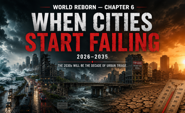
CHAPTER 6 — WORLD REBORN
WHEN CITIES START FAILING (2026–2035)
Cities are humanity’s greatest invention and its most concentrated vulnerability. They concentrate talent, capital, and innovation—but also heat, infrastructure dependency, and cascading failure risk. The next decade will determine which cities adapt and which become uninhabitable.
The Cascading Failure Mechanism
Traditional climate impact models consistently underestimate the severity of future urban extremes. The reason is methodological: models rely on short historical records and assume linear relationships between hazards and consequences. Real urban systems exhibit non-linear thresholds where small increases in stress trigger catastrophic system collapse .
Research presented at the Asian Conference on the Social Sciences (May 2026) operationalized a “downward counterfactual search” to expose latent urban vulnerabilities—extending analysis from physical “hazard space” into socio-economic “consequence space.” Using Singapore as a demonstrative case, researchers perturbed a historical 1978 flood event to generate three scenarios: a historical baseline, an operational extreme (1-in-100-year design limit), and a future extreme derived from Singapore’s Third National Climate Change Study .
The findings are stark. While current infrastructure remains resilient to historical and operational extremes, the future scenario triggers systemic failure. Inundation increases nine-fold over historical benchmarks, causing widespread gridlock that pushes nearly the entire city beyond critical 11-minute Emergency Medical Service response thresholds. When coinciding institutional failures (such as historical Mass Rapid Transit tunnel flooding) are incorporated, productivity losses exceed 915,000 hours .
This is not a Singapore-specific problem. It is a universal feature of complex urban systems. The non-linear thresholds that models miss are where cities actually fail.
The Doom Loop: How Remote Work Is Killing Urban Cores
The shift to remote work—now structurally entrenched at 15-25% of the workforce in major metropolitan areas—triggers not merely an office real estate crisis but a cascading physical degradation of urban cores that may prove irreversible .
The mechanism is now well-documented in urban economics literature as the “doom loop” :
| Phase | Mechanism | Timeline |
|---|---|---|
| 1 | Office vacancy rises (remote work persists) | 2024-2026 |
| 2 | Building revenues fall → maintenance deferred | 2025-2027 |
| 3 | Physical quality deteriorates → safety concerns | 2026-2028 |
| 4 | Tenants and customers avoid the area | 2027-2029 |
| 5 | Municipal tax base erodes → services cut | 2028-2030 |
| 6 | Further avoidance and vacancy | 2029-2031 |
| 7 | Point of no return | 2032-2035 |
The final phase occurs when demolition costs exceed property values, leaving condemned towers as permanent monuments to systemic failure .
Cities at highest risk —San Francisco, Portland, Chicago, Seattle—already exhibit early-phase symptoms. San Francisco’s office vacancy rate exceeded 35% in early 2026. Downtown foot traffic remains 40-50% below pre-pandemic baselines. The city’s budget deficit for 2026 is projected at $1.2 billion, driven primarily by collapsing commercial property tax revenue.
The doom loop represents what one paper calls “spatial debt collection”: cities borrowed future vitality by assuming perpetual office employment growth. Physical degradation is the mechanism through which that debt is collected, converting temporary vacancy into permanent exclusion zones .
The Terminal Diagnosis: New Orleans
New Orleans has received the most definitive diagnosis of any major US city. A perspectives paper published in Nature Sustainability (May 2026) concludes that coastal Louisiana has “evidently already crossed the point of no return” .
The arithmetic:
-
Sea level rise projections: 7 to 23 feet (3 to 7 meters) by 2100
-
Wetland loss: 75% of remaining coastal wetlands will disappear
-
Shoreline migration: up to 60 miles (100 kilometers) inland
-
Current population at major flood risk: 99% (highest of any US city)
The researchers state explicitly that New Orleans is the “most physically vulnerable coastal zone in the world.” Southern Louisiana is facing the convergence of three existential threats: sea level rise driven by global heating, strengthening hurricanes, and gradual subsidence of a coastline carved apart by the oil and gas industry .
The timeline: Jesse Keenan, an expert in climate adaptation at Tulane University and one of the paper’s coauthors, is blunt: “In paleo-climate terms, New Orleans is gone; the question is how long it has.” The timeframe for planning a retreat is “most likely decades rather than centuries.”
“Even if you stopped climate change today, New Orleans’s days are still numbered,” Keenan added. “It will be surrounded by open water, and you can’t keep an island situated below sea level afloat. There’s no amount of money that can do that.”
Louisiana has already lost 2,000 square miles of land to coastal erosion since the 1930s—equivalent to the size of Delaware. Another 3,000 square miles are projected to vanish over the next 50 years. The rate of land loss is so rapid that a football field-sized area is wiped out every 100 minutes .
The policy failure: A $3 billion sediment diversion project designed to rebuild coastal wetlands was scrapped by Louisiana’s governor in 2025, with one former official calling it a “boneheaded decision” that “resulted in one of the largest setbacks for our coast and the protection of our communities in decades.” The loss of this project, according to the Nature Sustainability paper, “effectively means giving up on extensive portions of coastal Louisiana, including the New Orleans area.”
The counter-argument—that New Orleans’ unique vulnerability doesn’t imply similar doom for all coastal cities—is valid but misses the point. As one analysis notes, Florida continues seeing explosive population growth despite similar risks, suggesting either rational confidence or collective denial . But New Orleans’ specific geological and political conditions make it the canary. “New Orleans is in a terminal condition, and we need to be clear with the patient that it is terminal,” Keenan said. “There is an opportunity for palliative care, we can transition people and the economy. We can get ahead of this.”
Heat: The Silent Urban Killer
While floods and storms capture headlines, extreme heat is the deadliest climate risk for cities—and the most inequitably distributed.
Rajshahi, Bangladesh (2035 projection): An AI-driven simulation using 24 years of Landsat satellite data (2000–2024) projected the thermal future of Rajshahi, a city on the margins of the arid Barind Tract. The findings: as ponds and canals (the city’s “blue lungs”) have been systematically replaced by concrete, Land Surface Temperature has surged. The simulation predicts that without immediate intervention, the city center will experience a temperature spike of 2-3°C by 2035, creating a “Heat Dome” effect where the absence of water bodies turns the urban core into an uninhabitable thermal zone during peak summer .
Jaipur, India (2000-2035): A comprehensive study at the School of Planning and Architecture, Bhopal (May 2025) tracked spatio-temporal dynamics of both Surface Urban Heat Island (SUHI) and Atmospheric Urban Heat Island (AUHI) in Jaipur from 2000 to 2024, projecting to 2035. The results show surface temperatures ranging from 30.4°C to 60.5°C over the 24-year period, with highly urbanized wards exhibiting the steepest increases. A Random Forest Regression model (R² = 0.806) projects continued intensification through 2035. Mitigation scenarios (green roofs, increased tree canopy, optimized parking) reduced peak daytime SUHI by up to 3°C in the densest wards .
Peshawar, Pakistan (2035-2050): A 2024 study in Heliyon predicting land use dynamics and surface temperature found that urban areas expanded by ~25% from 1990 to 2020, while urban vegetation decreased by ~10%. The city is projected to expand by ~45% by 2035 and ~56% by 2050. Land Surface Temperature is predicted to increase by ~55% by 2035 and ~82% by 2050. Urban Heat Island severity (measured by Urban Thermal Field Variance Index) is projected to increase by ~62% by 2035 and ~83% by 2050 .
The common pattern across three continents: Rapid urbanization without corresponding green infrastructure creates a thermal trap. The densest wards become the hottest. The hottest become the most dangerous. And the most dangerous become uninhabitable during peak periods—first for outdoor workers, then for the elderly and ill, eventually for everyone without air conditioning.
The Infrastructure Age Crisis: Bridges, Dams, and the 2035 Cliff
Cities are not just vulnerable to climate hazards. They are vulnerable to the age of the systems that keep them functioning.
Detroit bridges (2035 closure risk): The Michigan Department of Transportation announced in August 2025 that more than 100 trunkline bridges across the state are at risk of closure by 2035 without a comprehensive transportation funding package. These closures would impact approximately 1.8 million drivers daily. The westbound I-96 bridge over M-39 (Southfield Freeway) in Metro Detroit—carrying 45,000 vehicles per day—is one bridge explicitly at risk .
The cause is simple arithmetic: about two-thirds of MDOT’s bridge inventory has far exceeded its original design life (50-60 years). Because most bridges were built in the same post-war decades, they are aging in sync. Following the conclusion of the Rebuilding Michigan program, the annual reconstruction budget will drop from 495millionto222 million—a 55% reduction—supporting about 2,800 fewer construction jobs in 2026 alone .
Michigan dams (active failure, April 2026): The warning is not hypothetical. In April 2026, Michigan and parts of Wisconsin experienced historic flooding—days of heavy rainfall on top of snow that sent lakes and rivers over their banks and threatened several dams. Nearly half of Michigan’s counties were under a state of emergency. In Cheboygan, large pumps were brought in to lower pressure on a century-old dam in the city .
The region’s aging water infrastructure was never designed for the volume of water it is facing. Even prior to the 2026 floods, Michigan had a well-documented problem with its aging inventory of 2,600 dams. In May 2020, the Edenville and Sanford dams failed near Midland, forcing 10,000 people to evacuate and causing an estimated $200 million in damage. A state task force issued recommendations after that disaster. But a member of the task force told The Detroit News in April 2026 that little had been done to address those recommendations .
The University of Michigan professor emeritus of meteorology who authored the analysis is explicit: “Because warming will continue for the coming decades, the 2026 flooding should be considered at the lower end of capacity for stormwater infrastructure and dams. Rather than relying on the statistics that described floods in the past, planners will have to anticipate the floods of the future.”
The Consequence Cascade
The growing stream of climate consequences acts less like a single disaster and more like a threat multiplier that keeps returning with new tools .
Primary consequences (direct physical disruption):
-
Extreme heat, humidity, hydrologic instability
-
Drought, fire weather, storm intensity
-
Sea level rise, ocean stress, ecosystem damage
Secondary consequences (resource and service disruption):
-
Water stress, crop losses, fisheries decline
-
Infrastructure failures, power outages
-
Health burdens, disease spread, reduced work capacity
Tertiary consequences (human-system breakdown):
-
Insurance retreat, property value collapse
-
Migration, inflation, debt
-
Public fear, authoritarian drift, conflict
The 2026 Michigan floods illustrate the cascade perfectly: rain-on-snow (primary) → dam over-topping (secondary) → evacuation, economic disruption, infrastructure damage (tertiary). Each stage amplifies the next.
The 2028-2032 Convergence Window
The doom loop literature identifies a critical convergence window: 2028-2032. This is when multiple pressures peak simultaneously :
| Pressure | Peak Window | Mechanism |
|---|---|---|
| Office real estate collapse | 2028-2030 | Lease expirations, refinancing failures |
| Municipal budget crises | 2029-2031 | Tax base erosion, service cuts |
| Infrastructure failure wave | 2030-2035 | 50-60 year design lives exhausted |
| Climate hazard intensification | 2030-2040 | 1.5°C threshold crossed |
Cities facing all four simultaneously—San Francisco, New Orleans, Detroit, and many others—face an impossible choice: raise taxes on a shrinking base, cut services to essential systems, or default.
Chapter 6 Conclusion
The evidence supports a clear conclusion: the 2030s will be the decade of urban triage.
Not all cities will survive in their current form. New Orleans has received a terminal diagnosis. Detroit’s infrastructure is crumbling in sync. San Francisco’s downtown may never recover. And across South Asia, cities are becoming uninhabitable heat traps.
But triage is not uniform abandonment. Some cities will adapt. Some will shrink gracefully. Some will fail catastrophically. The difference will be determined by three factors:
-
Infrastructure investment pace — whether funding arrives before the 2030-2035 failure wave
-
Governance quality — whether cities can make unpopular decisions (managed retreat, tax increases, service consolidation)
-
Migration patterns — whether people leave in an orderly fashion or flee in panic
The 2028-2032 window is when these factors will be tested. The cities that survive will look very different from the cities of 2024. The cities that don’t will become case studies in what happens when systems designed for a stable climate meet a climate that is no longer stable.
Chapter 6 Source Index
| Source | Publication | Date | Link |
|---|---|---|---|
| van Gevelt, T. — Singapore Management University | Downward Counterfactuals Reveal Urban Vulnerabilities | April 2026 | ACSS Presentation |
| ArcGIS StoryMaps | The Vanishing Blue & The Rising Red: Rajshahi 2035 | Nov 2025 | StoryMaps |
| Yale e360 / The Guardian | Rising Seas Could Encircle New Orleans | May 2026 | Yale e360 |
| Michigan DOT | MDOT Metro Detroit Bridges at Risk of Closure by 2035 | Aug 2025 | Michigan.gov |
| Academia.edu | Doom Loops: Physical Degradation in Post-Office Urban Cores | Nov 2025 | Academia.edu |
| SPA Bhopal | Spatio-temporal dynamics of UHI: Jaipur case study | May 2025 | SPA Bhopal |
| PreventionWeb / The Conversation | Extreme rain on snow testing aging dams | April 2026 | PreventionWeb |
| Job One for Humanity | Primary and Secondary Climate Change Consequences | April 2026 | Job One for Humanity |
| PSIref / Heliyon | Land use dynamics and surface temperature: Peshawar | Oct 2024 | PSIref |